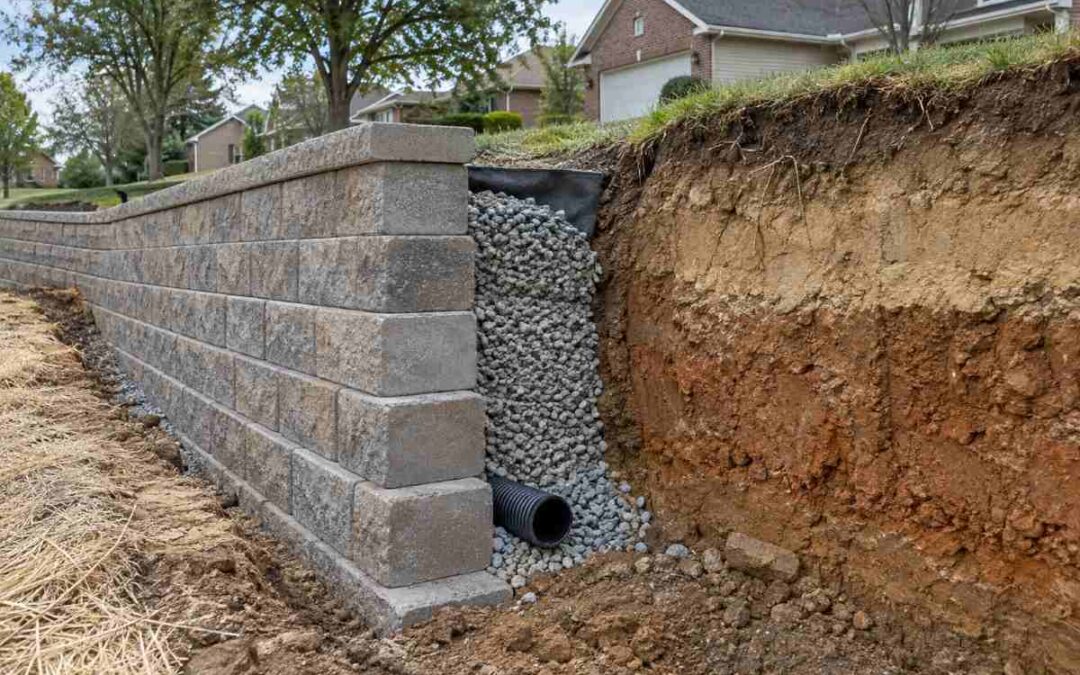
Missouri soil classification is the system for identifying a soil by its measurable properties and sorting it into groups that predict how it will bear load, move water, and shift with frost. It works through two frames at once. The USDA soil survey names a soil series, such as Menfro or Goss, by its profile and map unit. Engineering classification sorts that same soil into a USCS or AASHTO group by texture, gradation, and plasticity.
One frame names the soil. The other predicts how it behaves under a wall or a slab.
Across the St. Louis metro, that behavior changes by county, from the loess uplands of St. Louis County into the rockier, clay-variable Ozark border of Jefferson and Franklin. Classification turns that variation into four decisions a builder can act on. It sets how much load the soil carries, how it drains, and how deep a footing must sit to clear the frost line, and reading it wrong is what puts a wall out of plumb or a slab into a heave crack a season later.
At Retaining Wall & Paving Solutions, a licensed in-house professional engineer reads that classification into every structural design.
What Does Soil Classification Mean for a Hardscape Project?
Soil classification for hardscape runs on two systems at once. The USDA soil survey names a soil series, such as Menfro, by its profile and map unit, while engineering classification sorts that same soil into a USCS or AASHTO group by texture, gradation, and plasticity to predict how it bears load and handles water.
The two frames answer different questions. A soil series is an identity: it tells you which soil sits under the parcel and what its horizons contain. An engineering group is a behavior forecast: it tells you how that soil will act under a footing. A design needs both.
Use only the series name and you know what the soil is called, not what it will do under a wall. Use only the engineering group and you lose the horizon detail that explains why it behaves that way.
A soil series carries what a generic “clay soil” label cannot. It gives horizon-by-horizon texture, a drainage class, and the depth to any restrictive layer that would perch water or stop a footing. That last number decides how deep you can build before the soil changes on you.
Classification also sits on a real hierarchy, not a loose label. The USDA taxonomic ladder runs Order to Suborder to Great Group to Series, which places Menfro as a Typic Hapludalfs, a well-drained forest soil with a clay-enriched subsoil. Knowing the rung tells you what the soil shares with its relatives. It is the difference between a name and a classification.
The engineering frame assigns the same soil a USCS group symbol and an AASHTO group, and those symbols predict mechanical behavior the series name only implies. The Unified Soil Classification System sorts by grain size and plasticity under ASTM D2487-17(2025), and the parallel AASHTO sort for roadbeds and subgrades follows AASHTO M 145.
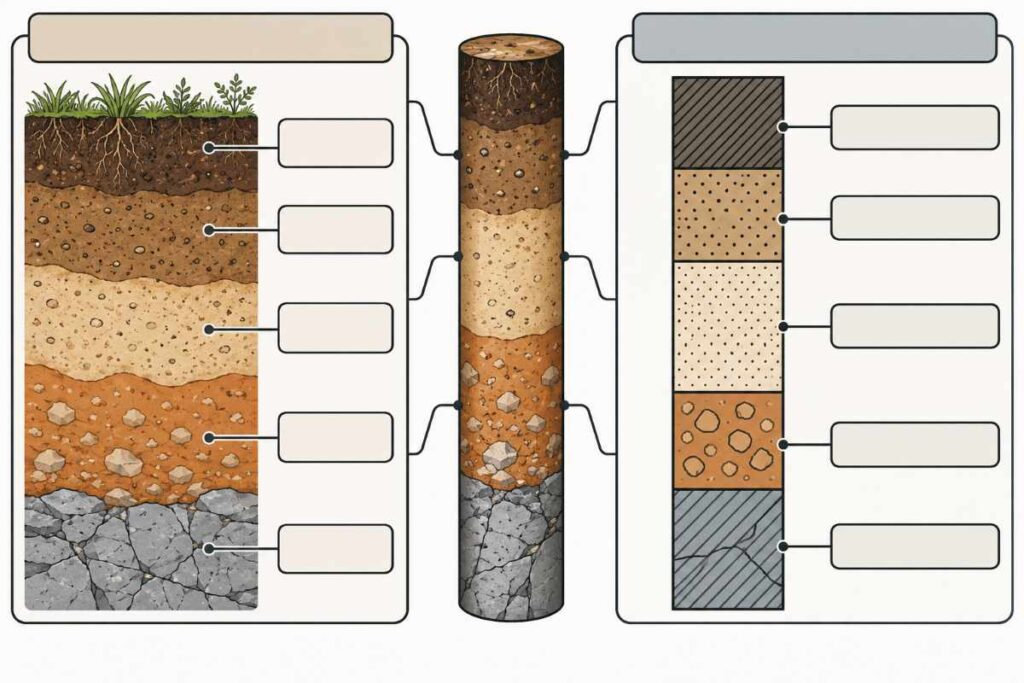
The metro’s soils fall into recognizable ranges. Well-drained silt loams land in the low-plasticity silt to lean-clay range, USCS ML to CL and AASHTO A-4 to A-6. Residual clays run heavier, USCS CL to CH and AASHTO A-6 to A-7-6, and alluvium spans both depending on the stratum. The ranges are the family, not the parcel.
The exact group for a parcel comes from one place. Pull it from the Web Soil Survey Engineering Properties table for the map unit, because a range tells you what to expect and the table tells you what is actually there. Assume the group instead of pulling it, and a footing sized for lean clay can end up bearing on fat clay.
How Do You Find Your Soil Classification by County?
Find your soil classification through the USDA Web Soil Survey, the federal tool that maps every parcel’s soil. Draw an area of interest over your property, read the map unit’s series and engineering data, then cross-check it against the published county soil survey for St. Louis, Jefferson, or Franklin County.
The workflow runs in five steps, all inside one free tool:
- Open the Web Soil Survey at websoilsurvey.nrcs.usda.gov and use the Area of Interest tab to draw a boundary over your parcel.
- Click the Soil Map tab to list the map units inside that boundary and name each soil series.
- Open the Soil Data Explorer tab, then Soil Properties and Qualities, to reach the engineering data for those map units.
- Read the Engineering Properties for each map unit, including the USCS and AASHTO groups, the plasticity index, and the liquid limit.
- Add the reports to the cart, check out for a PDF, and cross-check it against the county soil survey.
Draw that boundary tight. A map unit covers an area, not a point, so a small lot can straddle two of them, and a loosely drawn area of interest pulls a neighboring unit’s soil, which sizes the build for ground the wall never sits on. Read both units when a parcel spans them.
What a hardscape builder reads the report for is narrow. The Engineering Properties table gives the USCS and AASHTO groups and the plasticity index, and the paired shrink-swell rating flags the expansive clay that lifts footings and cracks slabs. The online tool summarizes those values; the published survey, such as the USDA soil survey of St. Louis County and St. Louis City from 1982, carries the fuller tables and the interpretations behind them. Pull both and you have the series and the engineering group the design decisions ahead depend on.
What Soil Types Dominate the St. Louis Metro?
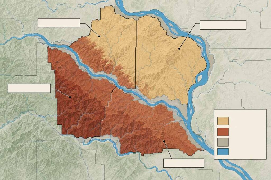
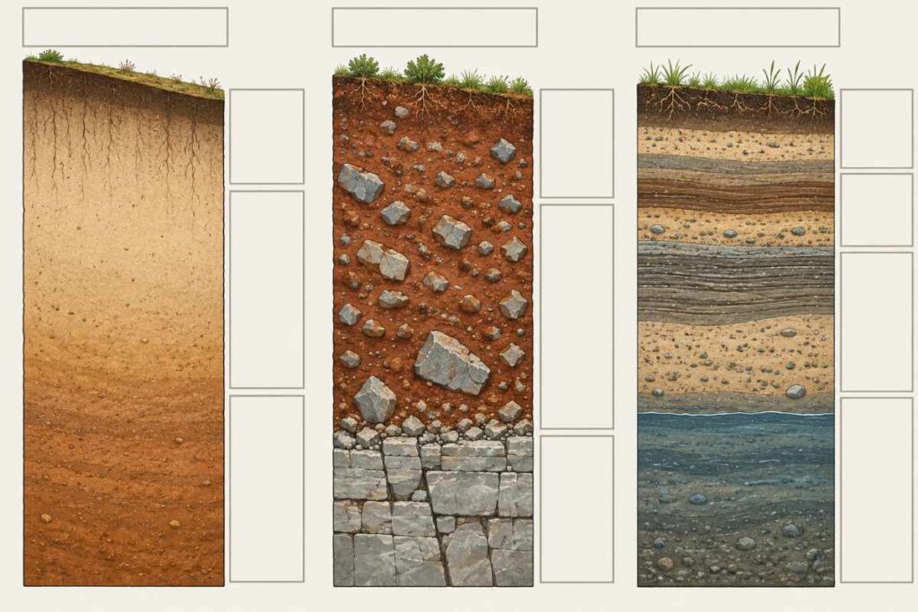
3 soil families dominate the St. Louis metro. Loess silt loams like the Menfro series sit on the uplands, cherty clay residual soils like the Goss series run along the Ozark border, and alluvial bottomland soils fill the river corridors. Each carries a different load, drainage, and stability profile, and each behaves differently under a wall.
How Does Loess Silt Loam Behave Under a Hardscape Load?
Loess silt loam, represented by the Menfro series, is a deep, well-drained upland soil with 27 to 35 percent clay in its subsoil. It bears hardscape load reliably when compacted, but it erodes readily on the steep backslopes where it often sits.
The profile is what makes it dependable under a footing. Menfro forms in thick loess, runs silt loam at the surface over a silty clay loam argillic, the clay-enriched subsoil that gives it body, and drains well through the whole column. Compacted to spec, that texture carries a wall or a paver base with predictable bearing.
The slope is the catch. Menfro sits on upland ridgetops and backslopes that range from 2 to 60 percent, and its surface runoff potential runs from low to very high as the grade steepens. On a steep site, water strips the silty surface before a base ever stabilizes, so a wall or patio there needs cut slopes held and drainage routed before install. The surface texture trends USCS ML to CL and AASHTO A-4 to A-6, with the exact map-unit group pulled from Web Soil Survey.
Why Do Cherty Clay Residual Soils Complicate Walls?
Cherty clay residual soils, represented by the Goss series, form over weathered dolomite and hold 15 to 75 percent rock fragments over a clayey subsoil. The clay and the variable rock make bearing and drainage harder to predict than loess.
Goss weathered in place from cherty limestone and dolomite, not deposited like loess. It runs gravelly silt loam at the surface, grades through silty clay in the subsoil, and reaches clay at depth, with chert fragments filling 15 to 75 percent of the profile.
The series drains well on paper. The problem is not standing water. It is variability.
Rock content swings from 15 to 75 percent within one profile. Bearing and drainage change foot to foot, so a footing on gravelly subsoil in one spot can hit dense clay a few feet over.
That clayey subsoil trends USCS CL to CH, with rocky horizons toward GC and AASHTO A-6 to A-7-6, and the exact map-unit group comes from Web Soil Survey. This section identifies the soil and how it classifies. The engineered design for a clay-loaded wall is its own subject.
Where Do Alluvial Bottomland Soils Cause Problems?
Alluvial bottomland soils in the Missouri, Mississippi, and Meramec river corridors are stratified and often poorly drained, with seasonal high water tables. That combination raises settlement and drainage risk for walls and slabs.
Alluvium is river-laid soil, dropped in layers as the current rose and fell. Those bands compress at different rates. Load a footing across them and the ground settles unevenly, which tips a wall and cracks a slab.
A shallow water table makes it worse. It saturates the subgrade and drives hydrostatic pressure against anything built into the soil.
Bottomland is why so many river-corridor parcels need engineered foundations rather than a standard base. Alluvium also carries no single engineering group. Stratified deposits span USCS ML to CH from one layer to the next, so the group has to be read per stratum from Web Soil Survey, never assumed from the surface.
How Does Soil Classification Differ by County?
St. Louis County runs on loess uplands, where Menfro and its Winfield companion dominate the ridges above Missouri and Mississippi River bottoms. Move south and west into Jefferson and Franklin, and the dominant upland shifts to Ozark-border cherty clay residuum as the terrain rises toward the dolomite plateau, with loess and river alluvium alongside it.
The table maps the dominant soils and their engineering behavior by county, so a builder can see which ground to expect before drawing a plan.
| County | Dominant upland soils | Dominant bottomland soils | Expected engineering group (family level) | Design default |
|---|---|---|---|---|
| St. Louis County | Menfro-Winfield loess uplands (about 64% Menfro in its association); Goss-Gasconade cherty uplands on the Ozark edge | Blake-Eudora-Waldron on Missouri and Mississippi bottoms; Wilbur-Haymond-Elsah on the Meramec | Loess silt loam USCS ML to CL, AASHTO A-4 to A-6; alluvium variable by stratum | Predictable loess bearing; compaction and slope drainage govern |
| Jefferson County | Sonsac-Useful-Moko cherty residuum dominant on the Salem Plateau; Wrengart-Goss on escarpments; Menfro-Gasconade minor | Haynie-Tice-Waldron on the Mississippi; Freeburg-Haymond-Horsecreek on Big and Meramec bottoms | Cherty clay residuum USCS CL to CH, rocky horizons GC, AASHTO A-6 to A-7-6 | Variable rock and clay; bearing and drainage read per parcel |
| Franklin County | Union-Goss-Gasconade and Hobson-Clarksville-Gasconade cherty residuum on the Ozark border | Haymond-Pope on the river bottoms | Cherty clay residuum USCS CL to CH toward GC, AASHTO A-6 to A-7-6; alluvium variable | Rockier, clay-variable ground; engineered design more common |
How Does Soil Classification Drive Retaining Wall Design?
Soil classification sets three inputs that decide how a retaining wall is built: the bearing pressure the footing carries, the drainage that relieves water behind the wall, and the footing depth that clears the frost line. Across the St. Louis metro, that frost depth is 30 inches.
Classification drives three design inputs:
- Bearing pressure: how much load the soil under the footing can carry without settling.
- Drainage system: what the wall needs to relieve water pressure building behind it.
- Footing depth: how deep the base must sit to clear frost and reach stable soil.
Bearing pressure is the first input soil sets. A well-drained silt loam compacted to spec carries a footing at a predictable pressure, so the wall sits level and stays level. A clay-variable or alluvial subgrade carries less.
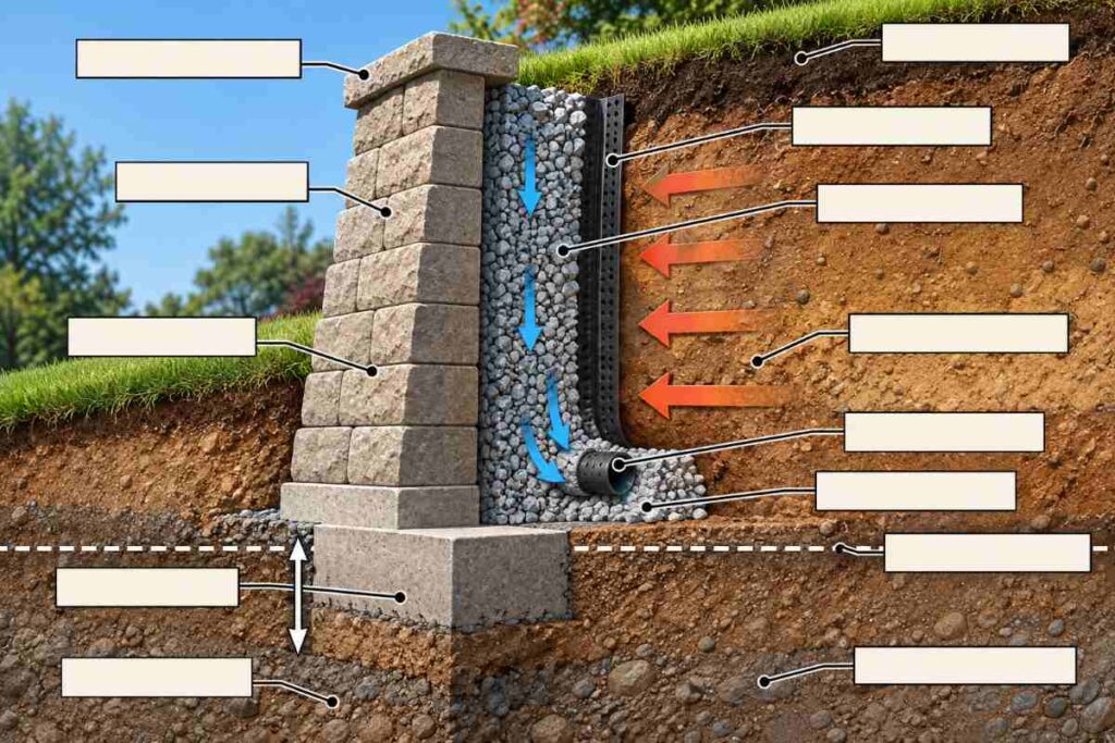
Soft clay compresses under load, and stratified alluvium settles unevenly, so the same footing that holds on loess can sink or tilt on bottomland. The lower the reliable bearing, the wider the footing has to spread that load. Classification signals that change before the first course goes down.
Drainage is the second input, and it runs on the soil’s permeability, so a freely draining subsoil lets water move through and away before pressure builds. A low-permeability subsoil does the opposite.
Water backs up against the wall and loads it with hydrostatic pressure, the force of standing water pushing on the structure. That pressure is one of the most common reasons walls fail. A tighter soil calls for more drainage: gravel backfill, a drainage board, and a working pipe to carry water off. This section holds at drainage-class level; the deeper behavior of expansive clay is its own subject.
Footing depth is the third input, and frost sets the floor on it. Water in the soil expands when it freezes, so a footing above the frost line heaves as the ground swells and drops as it thaws. Over a few winters, that movement cracks a wall.
The footing has to sit below that line on stable soil. Jefferson County and the City of St. Charles both amend IRC Table R301.2(1), the code’s climatic design table, to a frost line depth of 30 inches, the metro standard. Individual municipalities can still set their own figure. A builder confirms the adopted frost depth for the project’s jurisdiction before setting a footing.
How Does Soil Affect Paver and Flatwork Subgrade?
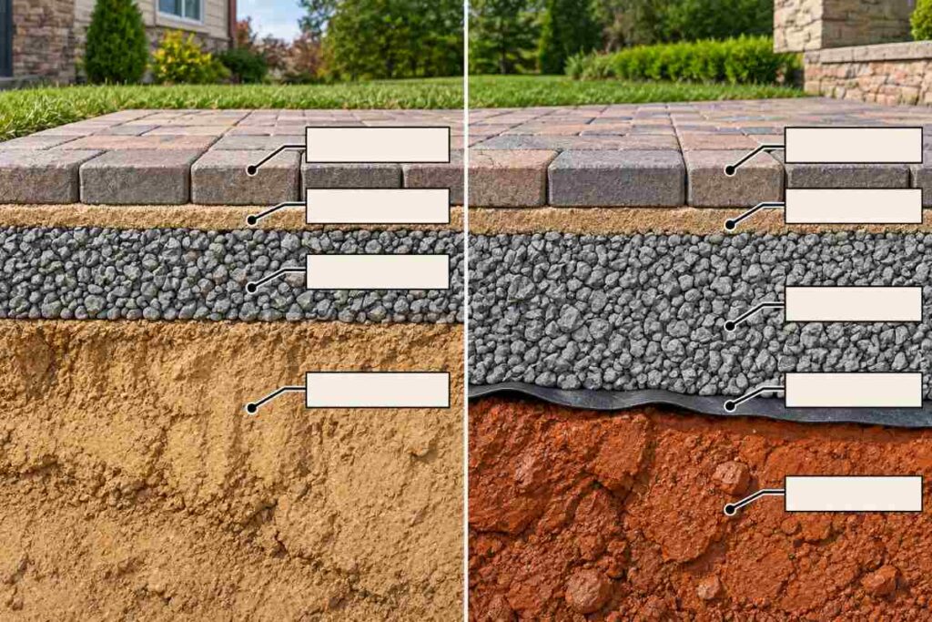
Soil classification sets how a paver or flatwork subgrade has to be prepared. A well-drained silt loam compacts into a stable base with standard prep, while low-permeability clay and alluvial subgrades need deeper aggregate, geotextile separation, or drainage before pavers or concrete go down.
The subgrade is the soil that carries everything above it, and its group decides the prep. Base depth and separation change with the soil:
- Loess silt loam: compacts to a firm subgrade, so a standard aggregate base carries pavers or a slab.
- Clay or alluvial subgrade: softer and less stable, so it needs a deeper aggregate base, geotextile separation fabric, or both.
Skip that adjustment on a clay subgrade and the base pumps fines up into itself under traffic, loses thickness, and lets the surface rut or settle. The fabric earns its keep here. Geotextile separation keeps the aggregate and the soft soil from mixing, so the weaker the subgrade, the more base and fabric the build needs.
Permeable pavers add a second demand. They only work if water can leave the base. A permeable system stores stormwater in an open aggregate base and drains it into the subgrade below.
A low-permeability clay subgrade starves that system. The water has nowhere to go, the base saturates, and it fails to drain.
That is why clay usually forces underdrainage. In the St. Louis metro, MSD requires a perforated underdrain in permeable interlocking concrete pavement, and where no infiltration test is run, it assumes a subgrade rate of 0.05 inches per hour, a clay-typical value. A builder confirms the drainage design with the district before a permeable system goes over clay.
When Does Your Soil Require a Licensed Engineer’s Design?
A retaining wall built on the wrong soil without engineering can settle, bulge, or fail outright, and an unpermitted structural wall is a code violation the owner has to remediate. A wall crosses into licensed-engineer territory when its height and the soil load behind it exceed what prescriptive design allows.
Two Missouri statutes set that line. The state defines the practice of professional engineering, including the design of structural works, under §327.181 RSMo. To perform that design, a person needs a license under §327.191 RSMo, which requires professional licensure and carves out limited exceptions.
Those exceptions are narrower than they sound. Section 327.191 lets an unlicensed person handle engineering work on a few specific structures, as long as they disclose they are not licensed:
- a single dwelling house, or a two-family dwelling;
- a building under 2,000 square feet holding no more than nine people;
- a structure used only for agriculture.
The honest reading is that structural wall design crosses into PE-required territory, not that every residential wall does. A short garden wall on stable loess sits inside prescriptive design. A tall wall, or one holding back a clay-loaded or saturated slope, is structural work where the exception runs out and a stamped design applies.
Soil and height set the trigger together. A height that is routine on well-drained silt loam becomes an engineered problem on expansive clay or alluvial bottomland. The soil load behind the wall and the bearing beneath it both change with the classification.
Skipping the engineered design carries a real cost. The wall can settle or move, the build can fail inspection, and the owner can be ordered to rebuild it to a stamped design after the fact. A clay-loaded or tall wall needs sealed drawings from a licensed professional engineer before it goes in the ground. Retaining Wall & Paving Solutions keeps one on staff.
How Do You Match a Hardscape Approach to Your Soil?
Match the approach to the soil. Well-drained loess uplands take standard walls and paver bases with routine prep, cherty clay residuum needs added drainage and often an engineered design, and alluvial bottomland usually needs an engineered foundation and a drainage system before any hardscape goes in.
Use the table to place your parcel, then confirm the soil group from Web Soil Survey before you commit to an approach.
| Soil group | Wall approach | Paver and flatwork approach | Engineering need |
|---|---|---|---|
| Loess upland (well-drained silt loam) | Standard wall on compacted base; hold and drain any cut slope | Standard aggregate base; routine compaction | Prescriptive design fits most walls; engineer a tall or surcharged wall |
| Cherty clay residuum (variable rock over clay) | Added drainage and a base sized for variable bearing; read the parcel before sizing | Deeper base and geotextile separation over the clay | Often engineered; variable bearing and clay push a wall past prescriptive design |
| Alluvial bottomland (stratified, high water table) | Engineered foundation and a drainage system; bearing read per stratum | Underdrainage and separation; permeable systems need an underdrain over clay | Engineered design the default; settlement and water table govern |
Soil series (USDA Official Series Descriptions)
- Menfro series (loess uplands, H3a / lede): https://soilseries.sc.egov.usda.gov/OSD_Docs/M/MENFRO.html
- Goss series (cherty clay residuum, H3b / lede): https://soilseries.sc.egov.usda.gov/OSD_Docs/G/GOSS.html
Classification standards (H2-1)
- ASTM D2487 (USCS), current version D2487-17(2025): https://store.astm.org/d2487-17.html
- Unified Soil Classification System (group definitions ML/CL/CH/GC): https://en.wikipedia.org/wiki/Unified_Soil_Classification_System
- AASHTO Soil Classification System (M 145, A-4/A-6/A-7-6): https://en.wikipedia.org/wiki/AASHTO_Soil_Classification_System
Soil retrieval workflow (H2-2)
- USDA Web Soil Survey (the tool): https://websoilsurvey.nrcs.usda.gov/app/
- USDA “How to Use Web Soil Survey”: https://www.nrcs.usda.gov/sites/default/files/2022-09/How-to-Use-WSS.pdf
- Getting Started with Web Soil Survey: https://www.nrcs.usda.gov/conservation-basics/soil/getting-started-with-web-soil-survey
- Soil Survey of St. Louis County and St. Louis City, MO (1982) — catalog: https://catalog.hathitrust.org/Record/101739763
- Same survey, full-text scan (association data source, H2-4): https://archive.org/details/usda-soil-survey-of-st-louis-county-and-st-louis-city-missouri-1982
County soil associations (H2-4)
- USDA Soil Survey of Jefferson County, MO: https://www.govinfo.gov/content/pkg/GOVPUB-A57-PURL-LPS49250/pdf/GOVPUB-A57-PURL-LPS49250.pdf
- MDC Bourbeuse River Watershed Assessment (Franklin County associations): https://mdc.mo.gov/sites/default/files/2021-12/050_2021_BourbeuseRiver.pdf
River corridors (H3c)
- Meramec River (metro corridor confirmation): https://www.britannica.com/place/Meramec-River
Frost depth / building code (H2-5)
- City of St. Charles Residential Code (30-in frost depth, §500.080): https://ecode360.com/27703188
- City of St. Charles Chapter 500 (Building Regulations): https://ecode360.com/27703153
- Jefferson County IRC amendments (30-in frost depth): https://ecode360.com/27891307
- St. Charles County Residential Building Code Amendments: https://www.sccmo.org/DocumentCenter/View/22409/2021-Residential-Building-Code-Amendments
Paver / stormwater (H2-6)
- MSD Project Clear — Permeable Interlocking Concrete Pavement (underdrain requirement): https://msdprojectclear.org/what-we-do/stormwater-management/bmp-toolbox/stormwater-quality/permeable-pavement/permeable-interlocking-concrete-pavement/
- ICPI Tech Spec 18 (PICP, general practice): https://www.cambridgepavers.com/dfiles/ICPI_Technical_Specification_18.pdf
Missouri PE licensing statutes (H2-7, Tier 1)
- §327.181 RSMo (defines PE practice): https://revisor.mo.gov/main/OneSection.aspx?section=327.181
- §327.191 RSMo (license required, exceptions): https://revisor.mo.gov/main/OneSection.aspx?section=327.191